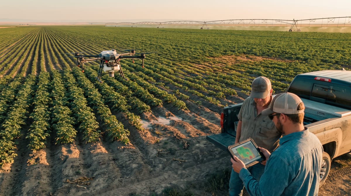
Automating the Overhead View: Drones Evolve in the Field
In 2026, agricultural drones are no longer only a tool for taking pictures from above. The article by Andrew Mabry in the Global Ag Tech Initiative drives home that unmanned aerial vehicles (UAVs), when combined with artificial intelligence and imaging technology, have become essential for converting aerial photos and sensor readings into usable field intelligence. The core benefit isn’t just more data but, crucially, faster detection of what has changed in the field, and where a grower needs to focus attention.
For operations across the irrigated potatoes of Idaho, the vast and remote croplands of Arizona, or specialty farms in Hawaii, the practical challenge has always been knowing where and when to walk fields, and what matters most amid the season’s variation. UAVs, equipped with the right suite of sensors and robust AI support, are now automating much of this prioritization work.
From Photo Collection to Actionable Insights
One of the major barriers to scalable aerial crop monitoring has been the sheer volume of data: hundreds or even thousands of images from a typical drone deployment. For a large operation, manually reviewing these images weekly is unworkable. The article points out that AI-supported processing bridges this gap, enabling rapid organization, comparison, and identification of changes or anomalies in the field imagery.
Instead of demanding a pixel-by-pixel review from an agronomist, machine vision software can flag spots where a field’s appearance has diverged from previous flights or neighboring zones. According to the article, the process takes shape like this:
- Drone Data Collection
- AI-Assisted Analysis
- Areas Flagged for Review
- Human Review and Field Inspection
AI, in this context, augments rather than replaces the agronomist’s judgment. Its key role is to filter and direct attention, ensuring that human time is spent where it is most needed. This aligns with the evolving model of precision agriculture decision-making, moving from blanket scouting to targeted response.
Mapping Field Variability: Beyond Uniform Management
Crop production almost never occurs uniformly across even a single field, a reality particularly familiar to growers in variable soils or microclimates. UAV platforms fill a gap left by coarser satellite or ground-level datasets, scanning entire areas to detect in-field differences and shifts over time.
Reliable field variability mapping supports tactical decisions, where to target scouting visits, where stress or abnormal growth is surfacing, and which zones may need additional monitoring. Drones equipped with multispectral or thermal sensors build these high-resolution maps, while AI-driven change detection highlights differences since the previous survey. For instance, canopy changes, crop pattern disturbances, or an altered thermal profile can all point to underlying issues such as irrigation faults or emerging stressors.
As described in the article, UAV data isn’t just another layer of aerial information, it serves as an early-warning system, allowing field teams to focus on the outliers and save time and labor on broad, less productive surveys. This supports practical objectives for repeatable, season-over-season monitoring, which is increasingly valuable as both labor costs and farming area expand.
Operational Efficiency Gains for Large and Remote Fields
Large operations, especially those in remote or labor-scarce regions, stand to gain the most. The article notes that “the use of UAVs will enable an aerial survey of the field before people determine the areas that require more detailed inspection on the ground.” This approach doesn’t replace agronomists or field scouts, but changes their workflow, reducing wasted effort and concentrating human expertise where it counts.
In Arizona vegetable fields or Hawaiian specialty crop blocks, for example, where access and time constraints loom large, being able to pre-identify only a handful of concern areas before heading out is operationally valuable. Over a season, this reduces total labor, speeds up issue detection, and leads to a better record of management actions, especially when matched to variable application or targeted input programs.
Repeat Monitoring and Change Detection Protocols
A one-off flyover gives a static snapshot, but it’s regular, repeatable monitoring missions that unlock the full power of drones in precision agriculture. The recommended workflow highlighted by the article is as follows:
- Initial Baseline Flight: Establishes reference conditions early in the crop cycle.
- Repeat Monitoring: Flies at scheduled intervals to build a temporal record.
- Change Detection: AI flags significant differences (by zone or timepoint).
- Human Review: Findings vetted by agronomists or managers.
- Field Verification: Targeted ground truthing in flagged zones.
- Follow-up: Ongoing tracking, linking changes to interventions or external factors.
This record becomes an asset season to season, enabling better documentation for insurance, compliance, and internal management, fitting into the documented, sensor-driven approach outlined in past guidance on drone crop scouting.
AI in Agriculture: Support, Not Autopilot
A critical point from the article is a recurring theme: AI-driven drone analysis is not a diagnostic silver bullet. Visual or sensor anomalies point to zones of concern, but interpretation still depends on agronomists and farm experts. Many crop issues, abiotic stress, nutrient deficiency, disease, or irrigation error, produce similar visible signals. Weather, development stage, and soil all play a role in how a stress manifests in the imagery.
This means that the field intelligence provided by drone and AI systems is most useful as a screening and prioritizing tool. The “what” of the anomaly comes from aerial data; the “why” generally still demands boots-on-the-ground field expertise. The combination, however, can make field walks more strategic and scalable.
Core Capabilities of Modern AI-Enabled Drones
Drawing from the article, several features define the current generation of precision-ag UAV solutions:
- AI-Assisted Image Analysis: Highlights field regions or patterns diverging from the norm.
- Automated Flight Planning: Supports repeatable routes for consistency and comparability over time.
- Multispectral and Thermal Imaging: Enables detection beyond visible issues, with insights into plant health, moisture, and canopy structure.
- High-Resolution Field Mapping: Provides detailed, actionable zone delineation, informing input and labor strategy.
- Change Detection: Compares historical and current datasets to focus scouting.
Pairing these with robust field recordkeeping and responsive management platforms elevates their value even further, especially in geographies and cropping systems where conditions are highly variable.
Implications for Growers and Agribusiness
For farm managers, agronomists, and service providers operating across diverse crops and environments, AI-powered drones are no longer just for imagery, they offer a scalable foundation for field intelligence, early stress detection, and better use of expertise. With labor at a premium and margins often tight, this approach helps optimize scouting, application programs, and risk mitigation.
Adoption is steered by specific goals. Are you trying to support a variable-rate input plan? Document a compliance record? Build season-over-season insights on abiotic stress? Modern UAV systems, paired with AI analysis, deliver actionable evidence rather than just more photos, reserving the hardest decisions for human expertise.
The role of drones in precision agriculture will continue to deepen as both data and field knowledge sharpen. But right now, AI-supported UAV fleets stand out as a practical way to see more of the field, find problems sooner, and allocate resources with unprecedented focus.